

Urban influence varies widely across the country
- by Austin Sanders and John Cromartie
- 2/4/2025
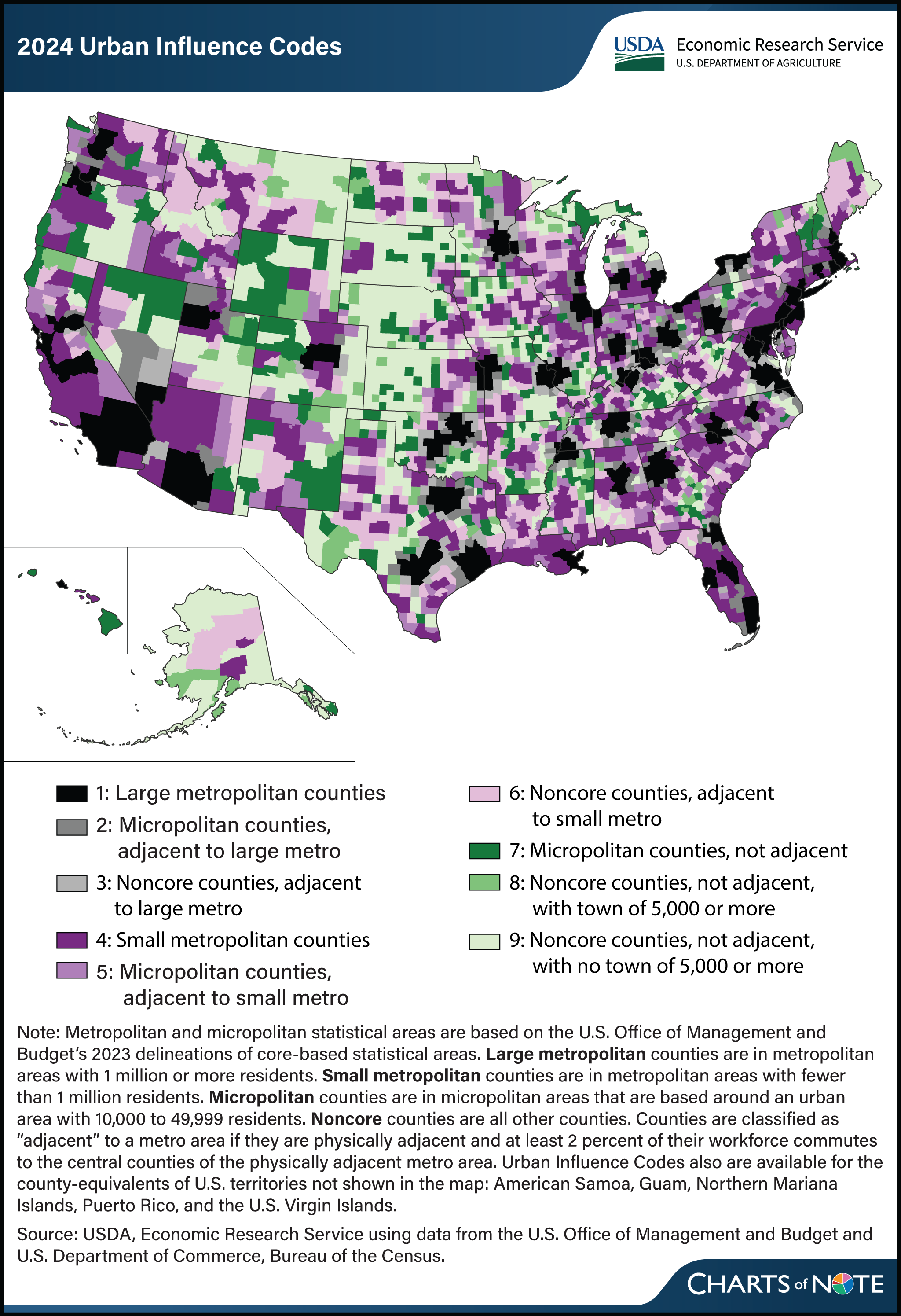
The USDA, Economic Research Service’s (ERS) Urban Influence Codes, updated in December 2024, classify all U.S. counties into nine categories based on their proximity to metropolitan (metro) areas and the size of their largest city or town. The degree of urban influence affects a county’s development through its effect on migration, employment, retail and wholesale trade, and access to national and international marketplaces. Since urban influence varies across the country, ERS researchers created the Urban Influence Codes to allow refined analyses of economic, social, and health factors at the county level. The codes range from counties located in metropolitan areas of 1 million or more residents (code 1) to isolated rural counties with no town of 5,000 or more residents (code 9). There are three major divisions within the hierarchy: counties that belong to or are adjacent to large metro areas of at least 1 million residents (codes 1-3), counties that belong to or are adjacent to small metro areas of fewer than 1 million residents (codes 4-6), and counties that are not adjacent to any metro areas (codes 7-9). Within the first and second divisions, adjacent counties within micropolitan areas (those that include urban areas with 10,000 or more people) are distinguished from adjacent counties (noncore counties) with smaller cities and towns. Within the third division, nonadjacent counties are distinguished by the size of the largest city within the county. The counties with the least amount of urban influence—remote rural counties—are heavily concentrated in the middle of the United States, while counties with greater urban influence are more common in the eastern part of the country. Smaller metropolitan areas and their adjacent spheres of urban influence are more prevalent in the western part of the country. For more information, see the ERS data product Urban Influence Codes.